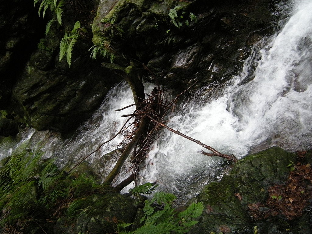
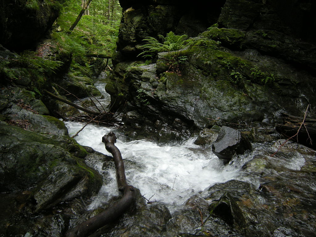
Waterfalls of the Silver creek, photo Stok
s e j n b o h e m i ae r o s a
S i t e B o d y E x p l o r a t i o n
The Golden Mountains - The Czech Republic & Poland
International Interdisciplinary Open-Air Workshop for artists and dancers exploring the relation between body, art and landscape
led by Frank van de Ven and Milos Sejn
Supported by Bohemiae Rosa Foundation – Jeseníky Protected Landscape Area – Světakraj o.s. – Babiogórski Park Narodowy
Waterfalls of the Silver creek, photo Stok
Since 1995 Milos Sejn and Frank van de Ven have co-operated in their bi-annual interdisciplinary open-air Body-Site-Exploration projects in various National & Cultural Reserves in the Czech Republic (Kokorin Valley, Plasy Monastery, Bohemian Karst, Bechyne Monastery with the Luznice River, Bohemian Paradise, Sumava and Krkonose Mountains, Kuks Spa, The Elbe Sandstone Mountains) known as the Bohemiae Rosa Project.
This
edition of the Bohemiae Rosa Project
will
take place in the Silesia/Moravia area known since the Middle Ages as "The
Golden Mountains" (Czech:
Rychlebské hory,
Polish: Góry
Złote,
German:
Reichensteiner Gebirge). In this mountain range in Eastern Sudetes on the border
between Poland and the Czech Republic we find forest mounts, old quarries,
caves, valleys, brooks, waterfalls, groves and meadows. Walking and working in
the Golden Mountains we investigate the numerous relations between Body and
Landscape and their significance to contemporary (Performing) Arts.
The program will include:
• MB -(mind/body, muscles/bones) dance training
• practice of and reflection on physical and mental training
• walking and wandering, silent walk, pilgrimage and nocturnal journeys
• various modes of experiencing body, movement and landscape
• investigating divergent senses of space and time
• peripatetic records, drawing, writing, immediate contact with surroundings
• mental topography of a location, myth, archaic mind and genius loci
• geology, archaeology and history of the Bohemian Paradise as a model of self: layers, vertical connections and labyrinths
An integral part of the workshop will be the individual artistic projects that participants are encouraged to formulate and work on for about 1 to 2 hours a day. (in the fields architecture, landscape art, dance, performance, photography, sculpture, theatre, visual arts, biology and natural history). The workshop leaders are available to guide and support these processes.
The body is a landscape in itself moving within the larger frame of the given surrounding environment. The vertical and horizontal layering of the (historical) landscape invites us to reflect upon our own layers and connections of self and imagination.
Participants profile: artists and advanced students working in performance, dance, landscape art, sculpture, photography, architecture, theatre, visual arts, biology and natural history. Selection of participants will be based on c.v. and motivation.
No previous (dance) training is necessary but the workshop will be physically demanding. A good overall condition is required.
05 – 10 September 2016, arrival in the evening of 04 September
Meeting Place: Zálesí 96, Javorník, Czech Republic
Landline: +420 584 440 564 / Mobil: +420 723 701 658
GPS: 50°21'37.888"N, 16°56'4.293"E
Accessibleby train from Prague to Zábřeh na Moravě and then continue to Lipová Lázně and after that to Javorník ve Slezsku which is the terminal station. Or by bus from Prague to Jeseník and then continue again by bus to Javorník. By car from Prague, through Hradec Králové, Kłodzko and Paczków in Poland to Javorník. Or by car from Wrocław, through Ząbkowice Śląskie. After that the distance on foot to the destination is 8 km. We can pick you up by car from Javorník station.
The number of participants is limited. We recommend early applications.
Bring work/sleeping pad, backpack for day hikes, raincoat and hiking boots.
There will be space to put up tents, bring one if you want.
All participants must have a personal insurance and must provide a copy of this before start of the project.
For artists and advanced students working in the fields of performance, dance, landscape art, sculpture, photography, architecture, theatre, visual arts, biology and natural history.
No
previous (dance) training is necessary but the workshop will be physically and
mentally
demanding,
therefore
a good overall condition is required.
APPLICATION
To apply send name, a short c.v. and a motivation letter to
Frank van de Ven
frank.bwa@xs4all.nl
or
Milos Sejn
milos@sejn.cz.
From
Bohemiae Rosa Project – September 11
2003 Bohemiae Rosa V
Bohemian Paradise
video
E X T E N D E D I N F O R M A T I O N
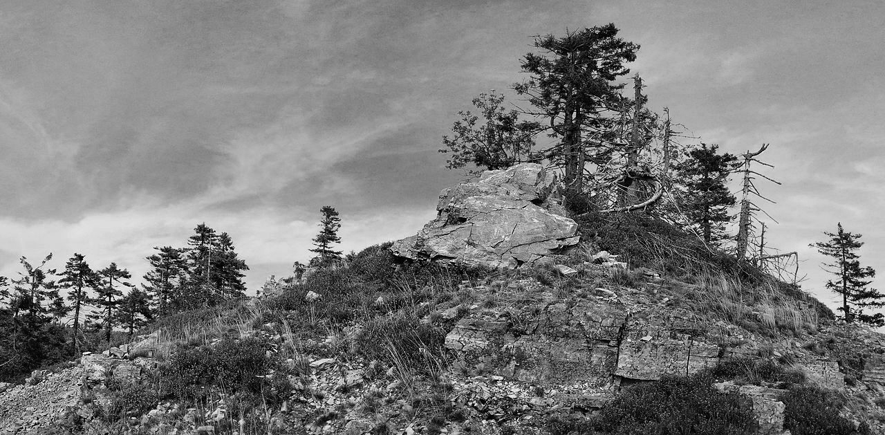
The Golden Mountains (Rychlebské hory), Bousek Hill
The Golden
Mountains (Czech
Republic/Polan)
Wikipedia
Name(s) of the
sandstone region (incl.
synonyms): The Golden Mountains
(Polish: Góry Złote,
Czech: Rychlebské hory, German: Reichensteiner
Gebirge) is a mountain range in Eastern Sudetes on
the border between Poland and the Czech Republic. The nickname comes from the
gold found in-between the mountains.
Geographical location: Das Reichensteiner
Gebirge erstreckt sich von Nordwest nach Südost. Seine nordwestliche Fortsetzung
ist das Warthagebirge (Góry Bardzkie), ein Teil des Eulengebirges und im
Osten das Zuckmanteler Bergland. Im Südosten grenzt es an das Altvatergebirge,
südwestlich liegt das Bielengebirge. Im Norden und Osten breitet sich die
schlesische Ebene mit dem breiten Tal der Glatzer Neiße und ihrer Zuflüsse aus.
Der tschechische Teil des Gebirges ist neuerdings ein Teil der Mikroregion
Rychleby.
Der größte Teil des Gebirges besteht aus Nadelwäldern, an manchen Stellen findet man auch Buchenwälder. In der Region findet man auch Wildschweine und Rotwild.
Der höchste Berg ist der Smrk (Fichtlich) mit 1125,4 m n.m. Höhe. Er befindet sich im äußersten Süden des Gebirges, über seinen Gipfel verläuft die Landesgrenze. Der 2 km südwestlich des Smrk liegende Gipfel des Postawna (1124 m n.m.) ist der höchste Gipfel des Bielengebirges.
Ein Ausläufer ist im Norden das Krautenwalder Bergland (Travenská hornatina) bei Travná (Krautenwalde). Dazwischen führt der Krautenwalder bzw. Landecker Pass (polnisch: Przełęcz Lądecka, tschechisch: Travenské sedlo) hindurch, der die Städte Lądek-Zdrój (Bad Landeck) und Javorník (Jauernig) verband. Im Süden des Gebirges schließen sich zwei ausgedehnte Ausläufer nach Osten an:
das Oberlindewieser Bergland (Hornilipovská hornatina), es erstreckt sich nördlich von Lipová-Lázně (Bad Lindewiese), darin befindet sich die Tropfsteinhöhle am Gemärke Jeskyně Na Pomezí, die teilweise begehbar ist. Das Gemärke ist ein alter Pass von Lipová-lázně (Bad Lindewiese) nach Vápenná (Setzdorf),
östlich schließt sich, getrennt durch das Tal der Vidnavka, der Nesselkoppenkamm, auch Hirschbadkamm (Sokolský hřbet) an, er liegt nördlich der Stadt Jeseník (Freiwaldau).
Geology
Am Aufbau des Reichensteiner Grundgebirges sind vor allem
kristalline Schiefer beteiligt, vor allem Gneise,
Glimmerschiefer sowie Hornblendeschiefer und
Quarzitschiefer. Granite sind das Massengestein, dazu gesellen sich weitere
Hartgesteine wie Syenite, Diorite, Gabbros und Serpentinite. Diorite kommen im
Osten des Reichensteiner Gebirges und des Bielengebirges vor. Die ältesten
Gesteine sind die vorkommenden Para- und Orthogneise. Diese alten Schichten
wurden aufgefaltet und Granite, Gabbros und Peridotite eingelagert. Diese
Prozesse haben sich im Unteren Karbon zugetragen. Zu dieser Zeitepoche gehören
auch die Tonalite des Reichensteiner und des Bielengebirges im Osten. Der
Friedeberger Granit als das größte Gesteinsvorkommen dieses Gebietes ist jünger
als die vorkommenden Tonalite. Des Weiteren bildeten sich der Saubsdorfer Marmor
und Marmur sławniowicki von Sławniowice (Groß-Kunzendorf) durch die Hitze und
Druck des Granitplutons von Žulová (Friedeberg) aus.
Im Reichensteiner Gebirge wurde bis ins 18. Jahrhundert intensiver Bergbau betrieben, danach waren die Lagerstätten erschöpft.
Erzlagerstätten Kupfer wurde im Melchior-Stollen bei Javorník (Jauernig) bei Zlaté Hory (Zuckmantel) gefördert; Kupferkies gab es in der Arsenerzlagerstätte von Reichenstein und des Weiteren wurde im Melchior-Stollen und in der Arsenlagerstätte Blei gefunden, ferner bei Lutynia (Leuthen) bei Bad Landeck. Zinkblende fand man bei Jauernig und Reichenstein, Magnetiteisenerz im Bielengebirge bei Waldeck und Gościce (Gostitz), bei Ondřejovice (Endersdorf) westlich von Zlaté Hory (Zuckmantel), Horní Údolí (Obergrund) und in Kletno (Grenzgrund) südöstlich von Wildschütz. Hämatit befindet sich nahe Mikulovice u Jeseníku (Niklasdorf) und Endersdorf. Bei den beiden letzteren Fundstätten kam Gold und Silber und bei Reichenstein in der Arsenlagerstätte, westlich des Schlackentales, vor. Dies war die größte Arsenlagerstätte des Gebietes. Flussspat fand sich bei Kletno (Klessengrund) und Asbest im Serpentinit in der Totenkoppe bei Jauernig und in Skorošice (Gurschdorf) beim Petershof. Graphit kam westlich von Bad Landeck, Leuthen und Jauernig vor.
Mineralfundstätten Quarz wurde früher bei Kobylá nad Vidnavkou (Jungferndorf) und Stará Červená Voda (Alt-Rotwasser) abgebaut und Quarzkristalle und -drusen finden sich im Friedeberger Granit. Korund befand sich im Gabbro von Uhelná (Sörgsdorf). Olivinkristalle werden im Basalt von Krautenwald bei Jauernig und Walbeck und Wollastonit wird im Kalk in der Nähe der Burg Kaltenštejn gefunden, ferner auch an diesem Orte Vesuvian. Epidotkristalle, Granat, Augit und Fergusit liegen am Gotteshausberg von Žulová (Friedeberg), Turmalin bei Jauernig, Andalusit in der Nähe von Krautenwalde.
Kohlevorkommen befinden sich im Neißevorland und bei Lentsch.
Gesteinsvorkommen Der wirtschaftlich bedeutendste Naturstein dieses Gebietes war der hellgraue, fein- bis mittelkörnige Granit, der in den 1930er Jahren in großem Umfang in Friedeberg, Domsdorf, Schwarzwasser, Setzdorf, Jungferndorf, Buchsdorf, Velká Kraš (Groß-Krosse) und Rotwasser gebrochen wurde. Unter einer ½ bis 10 Meter dicken Abraumschicht wurden Bau- und Werksteine und Pflastersteine gewonnen. Neben der Granitindustrie existierte aber auch die Marmorindustrie, die sich um die Vorkommen bei Saubsdorf und Groß-Kunzendorf konzentrierte. Die Marmor-Steinbrüche waren aufgrund der geringen Mächtigkeit im Gegensatz zum Granitvorkommen meistens sehr klein. Die Natursteine wurden in den 1930er Jahren in Schlesien, Mähren bis Brünn, Ostböhmen bis Hradec Králové (Königsgrätz), Polen, nach Holland, Belgien, England, Südamerika, Balkan und Indien verkauft.Große Bedeutung hatte die Kalkbrennerei, die im Gebiet um Vápenná (Setzdorf) urkundlich 1787 erstmals mit zwei herrschaftlichen Kalköfen erwähnt wird. 80 Prozent der gebrannten Kalke wurden nach Deutschland exportiert und der Rest von 20 Prozent nach Schlesien, Ostmähren und Ostböhmen. Gewisse Bedeutung für die Porzellanindustrie hatte Kaolin, der bei Vidnava (Weidenau) gewonnen wurde.
Geomorphology
Smrk / Smerek (Fichtlich),
1.125,4 m, 50° 14′ N,
17° 2′ O
Lví hora (Löwenkuppe), 1.040,1 m,
50° 15′ N,
17° 3′ O
Studniční vrch, 991,6 (Nesselkoppe, auch Hirschbad),
50° 16′ N,
17° 10′ O
Kovadlina / Kowadło (Schmiedekoppe), 988,9 m,
50° 16′ N,
17° 1′ O
Špičák, (Spitzberg) 957,2 m,
50° 18′ N,
17° 1′ O
Borůvková hora / Borówkowa (Heidelberg) 899 m,
50° 23′ N,
16° 54′ O
Koníček, (Rösselberg) 850,3 m,
50° 20′ N,
16° 56′ O
Černý vrch, (Schwartzberg) 825,8 m,
50° 19′ N,
16° 57′ O
Javorník (Jauersberg) 764 m,
50° 25′ N,
16° 52′ O
Bedeutende Orte in Polen
Lądek Zdrój
(Bad Landeck)
Stronie Śląskie (Seitenberg)
Złoty Stok (Reichenstein) in Tschechien
Bílá Voda (Weißwasser)
Javorník (Jauernig)
Travná (Krautenwalde)
Žulová (Friedeberg)
Contacts and
further information
https://commons.wikimedia.org/wiki/Category:G%C3%B3ry_Z%C5%82ote?uselang=de
https://de.wikipedia.org/wiki/Reichensteiner_Gebirge
http://geoportal.gov.cz/web/guest/map?permalink=ed3f25a2080e7708c28f3dfee2764b1d
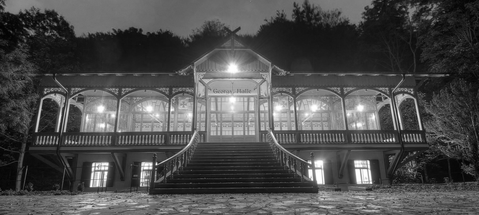
The Dance Hall / The Krayfish stream
One of our working
places will be
a
beautiful, historic
dance hall in the valley
of the Krayfish
stream.
The building was
fully
renewed
last year.
Dance Hall was built in the Art Nouveau style and belonged to the renowned tourist sites of Javornik residents and the surrounding area. Favorites were hiking from Javornik, over Jansky Hill, Devil's Pulpit, Rychleby castle and back to Crayfish Valley, or from New Vilémovice to Crayfish Valley through the Red Mine. Before World War II there were held entertainments on Saturdays, tea with music on Sundays. Surrounding picturesque place was embellished by park with rocks, rhododendrons, ornamental trees and stylish outdoor seating.
Art Nouveau Dance Hall served as a restaurant, a ballroom and a guest house (sources indicate its style as Swiss) built the bishop of Wroclaw, Cardinal Georg (George) Kopp in the years 1906-1907, on the site already mentioned demolished steam sawmill. According to Cardinal Kopp (1887- 1914), who is well known in our country by basing Vidnava Seminar for Priests, the dans hall got its name - Georgshalle. A concession to restaurant and bartender trade gained the bishopric December 17, 1906. Walled ground floor with a separate entrance was divided into two main sections, the other two rooms were located in the annex building. In the northern part of the ground (ie, toward Javornik) was located a large kitchen, bar and prep room. In the southern part was located a storage chamber (larder) and two living rooms. It was not forgotten, nor to sanitary facilities and even an elevator that transported food and drinks up into the hall. External stairs (now broken) led to over 20 meters long pub and dance hall, which was built all by wood and glass. The hall was surrounded by a wooden porch, lining has been colorfully painted wooden beams were decorated with plastic ornaments (especially vines) and the most beautiful parts of the Dance Hall was stained glass in blue and green tones, composed of secession canon. The entire building was electrified.
http://www.tancirna.rychleby.cz/
https://www.facebook.com/TancirnaCZ
From
Bohemiae Rosa Project – September 11
BIOGRAPHIES
Milos Sejn
works in the fields of visual art, performance and study of visual perception.
From the beginning of the 1960s he took pictures, drew, collected and described
his observations of nature during his wanderings through the Czech landscape.
Currently he teaches mixed media and the relationship of nature and art as
intrinsic needs of the mind, and focuses
on immediate creative possibilities, based upon relations between historical
humanized landscapes and intact nature.
CD ROMs: Colorvm Natvrae Varietas (Centrum for Culture and Communication in
Budapest c3, 2000); Make Your Own Island/Make Your Own Forest (Utrecht School of
the Arts, Institute for postgraduate and professional higher education in the
Arts, 2001); Books:
Being
Landscape, 2010
Frank van de Ven
is a dancer and choreographer who spend his formative years in Japan working
with Min Tanaka and the Maijuku Performance Company. In 1993 he founded together
with Katerina Bakatsaki
'Body Weather Amsterdam', a platform for training and performance. Since
1995 he conducts with Milos Sejn the interdisciplinary Bohemiae Rosa Project,
connecting body and landscape with art, geology and architecture. Interest in
dance and theory led to the 'How to make yourself a Dancing Body Without Organs'
Project. Together with Peter Snow (Monash University) he performs the famed
Thought/Action Improvisations. An ongoing collaboration exists with
musician Daniel Schorno, artistic director of Steim Amsterdam.
Films
(video and 16mm): Dancing Plasy Times 8, CI-VIT, LOM and NOUGHTS.
Dictionary definitions
*site n., pl. -s [Latin situs "place, position", from sinere "to leave, place, lay"] 1. the actual or planned location 2 the place or scene of something (a camp site) / site vt., to place on a site or in position: locate
*body n., pl. -ies [OE, bodig, cask] 1. the whole physical substance of a man, animal or plant 2. the trunk of a man or animal 3. a corpse 4. [Colloq.] a person 5. a distinct mass [a body of water] 6. a distinct group of people or things 7. the main part 8. substance or consistency, as of liquid 9. richness of flavor
*landscape n., pl. -s [Dutsch landschap, from land + -schap "-ship"] 1. a picture of natural inland scenery 2. a portion of land that the eye can see in one glance
*wander vb., wan-dered, wan-der-ing [OE, wandrian] 1. to move about aimlessly or without a fixed course or goal: ramble 2a to deviate (as from a course): stray 2b to go astray morally: err 2c to lose normal mental contact (as delirium or madness)
*walk n., pl. -s [vb OE, wealkan "to roll, toss"] 1. a going on foot (go for a walk) 2. a place, path, or course for walking 3. distance to be walked 4a manner of living 4b social or economic status (various walks of life) 5a manner of walking 5b a gait of a four-footed animal in which there are always at least two feet on the ground
 s
s
Waterfalls of the Silver creek, photo Stok